Data Products
SOMA
The Algarve Operational Modelling and Monitoring System, or simply SOMA, is the high-resolution operational model, based on the MOHID Modelling System environment, designed to reproduce the Portugal south coast dynamics. The model encompasses two levels of increasing resolution, using bathymetric data from the European Marine Observation and Data Network (EMODNET). The first level uses a 2 km horizontal resolution grid and the second a 1 km grid. Both have the same vertical spatial discretization with 50 layers of cartesian coordinates. At the open boundary, conditions for temperature, salinity, and current velocities are supplied by Mercator Ocean Analysis and Forecast provided by Copernicus Marine Environment Monitoring Service (CMEMS). Tides are given by the FES2014 global solution, and for the atmospheric forcing fields, SOMA uses the results of the regional weather forecast system SKIRON, provided by Atmospheric Modeling and Weather Forecasting Group of The National and Kapodistrian University of Athens.
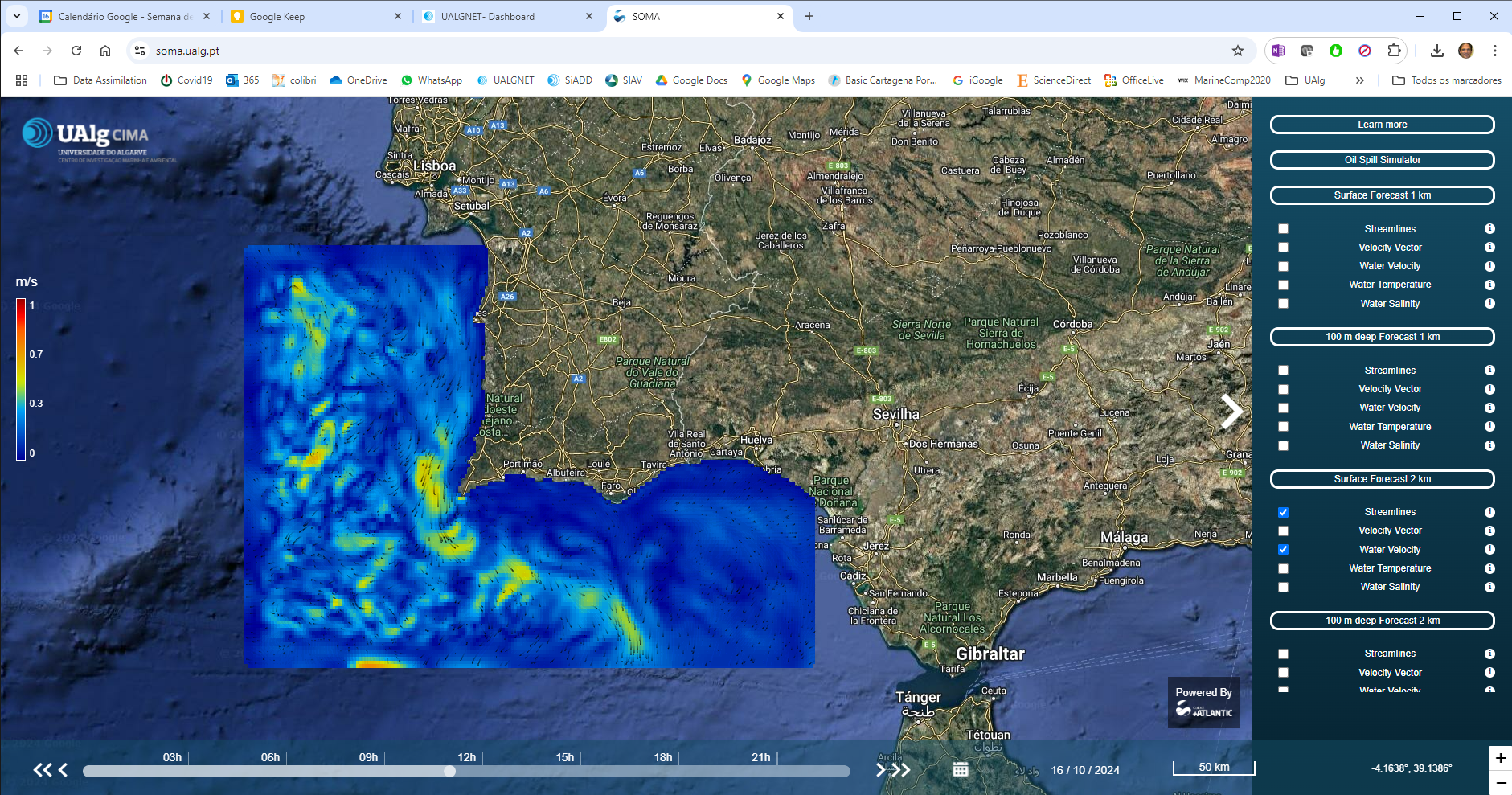
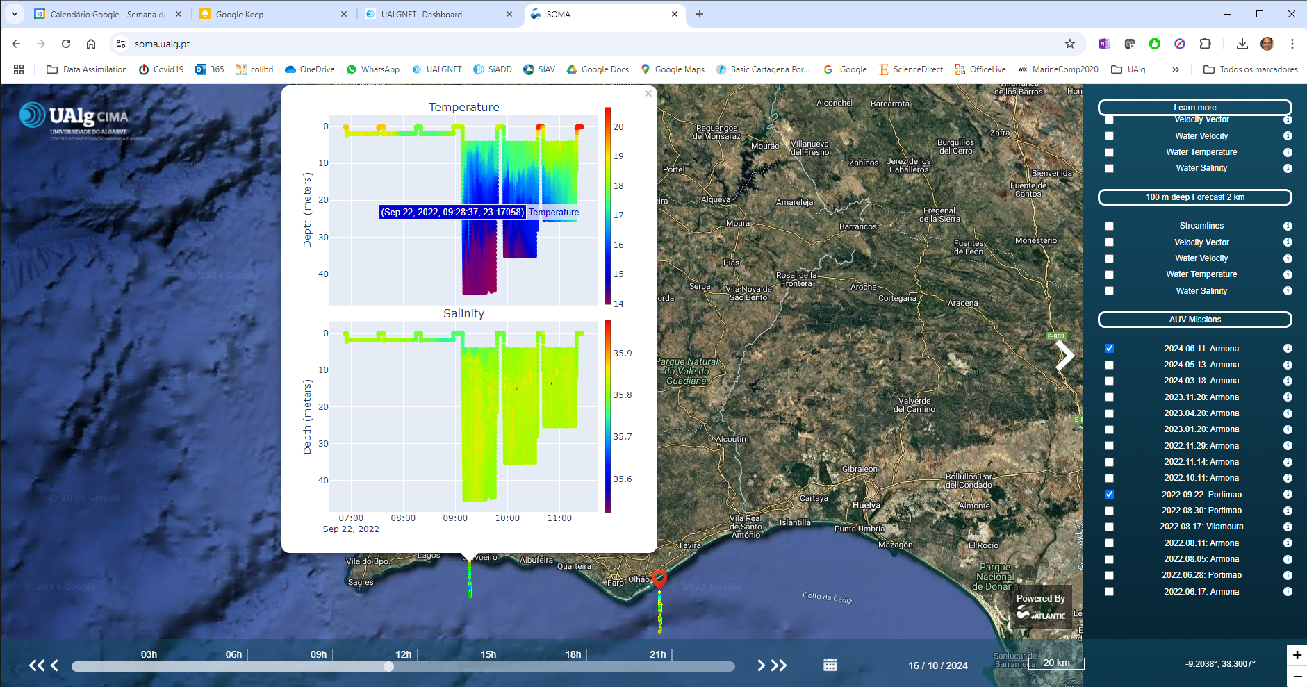
Interface do SOMA: https://soma.ualg.pt/
Database: https://cima-somathredds.ualg.pt/thredds/catalog/SOMA/catalog.html